
Carretera Austral Sur
Coyhaique to Villa
O´Higgins
SUGGESTED ITINERARY – From North to South
Coyhaique to Villa O Higgins.
You will need time to enjoy trekking, kayaking, fishing and other outdoor activities.
We have designed this itinerary with some extra days.
IF YOU WANT YOU CAN SPEED UP AND CYCLE FASTER, OR REDUCE YOUR SPEED IF YOUR LEGS ARE TOO TIRED AND REST A COUPLE OF DAYS.
WE SUGGEST TO SPEND 14 DAYS ON CARRETERA AUSTRAL.
DAY 1: Arrival at Balmaceda Airport
To get to Balmaceda, you can fly directly into Balmaceda Airport (BBA) from major cities like Santiago and Puerto Montt. Balmaceda is about 55 kilometers of Coyhaique.
Flights: Several airlines, including LATAM and Sky Airline, offer direct flights to Balmaceda from Santiago and other major cities.T
The stretch from Coyhaique to Cerro Castillo is a classic ride on the Carretera Austral — 97 kilometers of winding roads, open valleys, and unforgettable mountain views.
If you’re well-prepared and fit, it can definitely be done in a single day.
Our advise is to take it slow and soak it all in, we recommend splitting it into two:
– Day one from Coyhaique to the small village of El Blanco
– Day two from El Blanco to Cerro Castillo, where you’ll conquer the legendary Cuesta del Diablo — a challenging climb with epic rewards at the top.
DAY 2. Coyhaique to Villa Cerro Castillo: Rock Formations, Turquoise Rivers and the Cuesta del Diablo Distance: approx. 95 km | Elevation gain: +700–900 m | Road condition: paved
Leaving Coyhaique, the road opens up into wide Patagonian valleys and long, gentle straights that make the first part of the ride feel surprisingly smooth and fast. The surface is fully paved, and the terrain is mostly flat to gently rolling, allowing you to build a steady rhythm as the city slowly fades behind you and the wild landscapes return.
Near the small area known as El Blanco, the scenery takes on a surreal feel. Strange and fascinating rock formations, shaped by centuries of wind, ice and geological forces, rise from the land like silent stone sculptures. These formations, part of an ancient volcanic and sedimentary history, give the landscape an almost otherworldly appearance and make this section one of the most visually unique of the entire Carretera Austral.
As you continue south, the environment shifts once again. Towering peaks begin to dominate the horizon, signaling your arrival to the legendary Cerro Castillo National Park. This protected area is famous for its jagged mountains, turquoise lagoons, hanging glaciers and dramatic alpine landscapes — often compared to Torres del Paine in its beauty and intensity.
Then comes the highlight (and the test): La Cuesta del Diablo. This iconic climb is one of the most challenging stretches of the whole journey. The road rises in sharp curves, demanding strength, focus and patience. Every turn reveals bigger views — deep valleys, snow-capped peaks and endless Patagonian sky. It is difficult, yes… but also one of the most rewarding climbs you will ever experience on a bicycle.
After conquering the Cuesta del Diablo, a long, flowing descent takes you straight into Villa Cerro Castillo, a small mountaineer town nestled at the entrance of the national park. Surrounded by towering rock spires and icy rivers, it feels like a true basecamp for adventurers.
Here, you can rest, refuel, explore hiking trails, or simply sit back and admire one of the most spectacular backdrops of the entire Carretera Austral.

DAY 3. Villa Cerro Castillo to Puerto Río Tranquilo: Turquoise Rivers and the Road to the Marble Caves Distance: approx. 119 km | Elevation gain: +400–500 m | Road condition: mostly paved.
Leaving Villa Cerro Castillo, you ride straight into one of the most visually stunning sections of the Carretera Austral. The road winds alongside the turquoise Ibáñez River, its surreal blue color flowing between steep canyon walls and rocky cliffs. This stretch is mostly paved, but still includes some gravel sections that keep your focus sharp and your true adventure spirit alive.
The terrain is a mix of gentle descents, rolling hills and long open valleys framed by dramatic mountains. Massive rock walls rise on one side while wide Patagonian landscapes stretch out on the other. Waterfalls appear unexpectedly along the way, and every turn of the road offers a new panoramic view — snowy peaks, deep canyons, and endless sky.
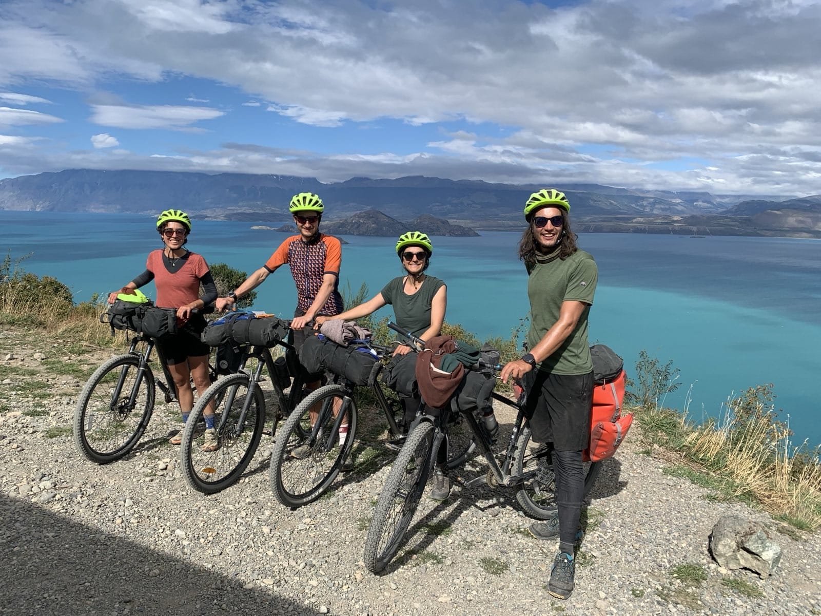
As you get closer to Puerto Río Tranquilo, the scenery changes once again. The landscape opens up and the immense General Carrera Lake begins to reveal itself in the distance — a deep, electric blue lake so vast it feels like an ocean surrounded by mountains.
Arriving in Puerto Río Tranquilo feels like stepping into a small expedition base. This lively little village is famous for one of the greatest natural wonders in Chile: the Capillas de Mármol (Marble Caves). From here, you can take a boat or kayak tour to explore the incredible marble formations carved by water and wind over thousands of years — swirling white and blue patterns reflected on the lake’s surface.
Beyond the caves, Tranquilo also offers glaciers, hidden lagoons, bike routes, trekking trails, camping areas, small lodges and local restaurants where you can enjoy a warm meal overlooking the lake. Many cyclists choose to stay an extra day here to fully explore the area and give their legs a well-deserved break.
This is not just a stop on your journey — Puerto Río Tranquilo is one of the true highlights of the entire Carretera Austral.

DAY 4: Rest Day in Puerto Río Tranquilo – Marble Caves & Glacier Exploradores
You’ve arrived in Puerto Río Tranquilo, one of the most scenic and unforgettable stops along the entire route. No kilometers to cover on your bike today, but there’s plenty to discover.
First, the star of the show: the Catedral de Mármol, or Marble Caves.
These surreal rock formations rise directly from the turquoise waters of Lago General Carrera. Sculpted over thousands of years by waves and wind, the caves glow in swirling patterns of blue and white — and the best way to see them is by kayak or small boat.
Sunlight reflects off the water and dances along the stone, creating a dreamlike, otherworldly experience. Early morning is best, when the light is soft and the water calm. It’s not just beautiful — it’s peaceful, meditative, and completely unique.
If you’re looking for a different kind of adventure, head inland toward the Glaciar Exploradores.

DAY 5: Puerto Río Tranquilo to Puerto Bertrand – 57 km
A journey of about 57 kilometers, filled with dramatic lake views, hidden valleys, and the powerful presence of the Río Baker.
Leaving Puerto Río Tranquilo, the road quickly returns to gravel. You’ll ride along the southern edge of Lago General Carrera, the largest lake entirely in Chile, with its signature deep turquoise color on full display. The road rolls gently at first, with some short climbs and descents hugging the cliffs and hillsides.
About halfway through the ride, you’ll pass close to Bahía Murta, a tiny settlement nestled on the lake’s edge. It’s a good place to rest, grab a snack, or chat with locals if you’re in no rush. From here, the landscape becomes even wilder.
You’ll continue along the lake before the road turns slightly inland, following a chain of valleys and glacial streams. Eventually, you’ll arrive at the northern tip of Lago Bertrand, where the lake empties into the Río Baker — Chile’s most powerful river.
DAY 6: Puerto Bertrand to Cochrane: Riding Beside the Wild Baker River Distance: approx. 45–50 km | Elevation gain: +250–350 m | Road condition: mostly gravel
From the moment you leave Puerto Bertrand, the road begins to follow the legendary Baker River, Chile’s most powerful and voluminous river. The surface here is mostly gravel, with some short paved sections, adding a raw and adventurous feel to the ride. Dust, stones and occasional washboard will keep you alert, while the constant sound of rushing water is your soundtrack for the day.
The surreal turquoise color of the Baker River accompanies you through deep canyons and wide valleys, creating one of the most striking visual contrasts of the entire Carretera Austral. Along the way, you’ll pass several viewpoints where the river squeezes through narrow gorges, forming fierce rapids that can be heard long before they’re seen. This powerful presence turns the road into a moving viewpoint.
The terrain is mostly rolling, with gentle ups and downs and a few short climbs, making it physically manageable but never boring. Condors sometimes glide above the cliffs, and open Patagonian landscapes alternate with forested sections and wide grazing fields.
As you approach Cochrane, the scenery begins to open up even more. This welcoming town is considered the gateway to the Northern Patagonian Ice Field. Here you’ll find supermarkets, restaurants, hostels, gear shops and a peaceful plaza — the perfect place to rest, resupply, and prepare for the most remote and wild section of your journey toward Caleta Tortel and Villa O’Higgins.

DAY 7: Cochrane to Los Ñadis: Into the Remote Silence of Southern Patagonia Distance: approx. 60 km | Elevation gain: +400–500 m | Road condition: gravel
Today we leave behind the last major town on the route — Cochrane — and ride into the true wilderness of southern Patagonia. The destination: a remote riverside area known as Los Ñadis, about 60 kilometers south, perfect for a night of camping under the stars.
Leaving Cochrane, the road turns to gravel almost immediately. There are no towns, no gas stations, and no cell signal ahead — only forest, rivers, and the open sky. This is where the Carretera Austral begins to feel wild and untamed.
The terrain is rolling, with small climbs and descents, crossing through dense lenga forests and over crystal-clear creeks. The road surface varies — from smooth compact gravel to rough, rocky patches — so take your time and enjoy the solitude.
This part of the route follows the Río Baker for a while, and you’ll be surrounded by massive, untouched landscapes. Waterfalls fall from cliffsides, eagles glide overhead, and the only sounds are wind, water, and your tires crunching gravel.
DAY 8: Los Ñadis to the X-904 junction – 60 km
Today, you ride even further into Patagonia’s wild heart — from your campsite near Los Ñadis, along the southern reaches of the Carretera Austral, until you reach the junction with Ruta X-904, the road that leads to Caleta Tortel. It’s a 60-kilometer ride through silence, solitude, and raw nature.
From the very start, you’re alone with the landscape. The road is 100% gravel, winding through narrow valleys, old-growth forests, and steep river canyons. There are no towns, no stores, no signs — just the occasional wooden bridge, the call of birds, and the distant echo of the wind through the lenga trees.
As you ride south, the terrain becomes increasingly varied. Expect short but steep climbs, sections of rough road, and the occasional muddy stretch — especially after rain. Some descents are rocky and technical, so stay alert and take breaks when needed.
But with the difficulty comes beauty. The region is shaped by glacial erosion, carved into jagged ridges and deep valleys.
DAY 9: Junction with Ruta X-904 to Caleta Tortel – 22 km
Today marks a special transition — from gravel road to wooden walkways, from the forests of Patagonia to the edge of the Pacific fjords. You’re riding the final 22 kilometers of the ruta X-904, all the way to Caleta Tortel, one of the most unique and magical villages in all of Chile.
The road starts as a narrow gravel track, winding through lush forest and following the curves of deep river valleys. There are no shops, no traffic lights — just the sound of your tires on ripio, the rustle of the trees, and the anticipation of the sea.
The terrain is undulating but manageable, with a few short climbs and descents. About halfway through, the road begins to descend toward the coast, revealing dramatic views of the Baker River delta opening into the fjords. The air changes — you’ll smell salt and feel the cool breeze of the ocean.
And then, suddenly, you arrive.
Caleta Tortel appears like a dream — built entirely on wooden walkways, with no cars, no streets, and no concrete. Every building is connected by raised cypress-plank boardwalks that curve and climb through the cliffs and along the water’s edge.

Bike and Outdoor Rental
Need a quote?
Send us an email to: info@australbikes.cl
NEED LODGING?
Please, write us a message: info@australbikes.cl if you need help with some bookings, although we advise that only for your first and final dates.
It’s very risky to do that for other days, as you may need more days to explore while on your journey, or the road might be closed for one or two days due to climate: rain, snow or river floods.
Total distance: 562 km.
Total days: 14
Difficulty: High
Road type: 20% pavement – 80% gravel.
self guided tour
included
__________________________________________
Bike rental: 14 days included. Excellent quality bikes, Merida brand, specially selected for the trails of the zone and the gravel road on Carretera Austral (easily handleable).
Bike Pickup at Coyhaique
Bike Dropoff at Villa O Higgins.
All of our services include: Topeak Explorer Rear Racks, Ortlieb waterproof panniers 40 lts (20 lts each side), handlebar bag (15 lts), mini-triangular frame bag, Gyro helmets, bottle cage, lock, lights, spare tubes, multi tools, tyre levers, allen wrench set, pump, chain cutter, quick link, patches, glue and reflective vests.
Our network of over 100 establishments along the Carretera Austral – from Puerto Varas to Villa O’Higgins – including hotels, hostels, cabins, campsites, restaurants, tourist activities, and shops, that offer special discounts.
not included
Airport transfer to Coyhaique: arrival from Balmaceda Airport – Coyhaique.
Bus Returning from Villa O Higgins to Cochrane and bus returning from Cochrane to Coyhaique.
– Bus/Air Flight Tickets Returning from Coyhaique to Santiago.
– Tickets for any of the ferries.
– Airport transfer to Balmaceda Airport from Coyhaique: Return to Santiago.
– Guide
Why choose us?
Because we’re not just handing you a bike — we’re riding with you every step of the way.
Top-quality MTB bikes (Merida) built for Patagonia’s wild terrain.
Fully equipped: Ortlieb waterproof panniers, handlebar bag (15 litres), mini-triangular frame bag, helmets, locks, front and rear lights, gel seat cover, spare tubes, tools and reflective vests. — all included in the rental. No hidden fees.
Mechanical support all along the route: with our network of 22 trusted mechanics.
Luggage forwarding, from your starting point to either destination you choose: Puerto Varas, Coyhaique, Puerto Rio Tranquilo or Villa O’Higgins, so you can ride light and free.
Flexible pick-up and drop-off locations: Puerto Varas, Coyhaique, Puerto Río Tranquilo, and Villa O’Higgins.
And most importantly:
We’re available on WhatsApp 24/7 during your trip — so you’ll never be truly alone out there.
make your reservation
DAY 10: Rest Day in Caleta Tortel – Explore the Wooden Village
After riding over 1,000 kilometers through the wilds of Patagonia, today is for resting — and discovering the magic of Caleta Tortel, one of the most unique and enchanting villages in the world.
No need for pedals today. Instead, you’ll explore a town built entirely on wooden walkways, perched between the mountains and the sea. With no streets, no cars, and no noise but the ocean, Tortel invites you to slow down — and look around.
Here are some ways to make the most of your rest day:
1. Wander the Pasarelas (Walkways):
More than 7 kilometers of cypress-plank boardwalks wind through cliffs, coves, and hilltops, connecting homes, viewpoints, and plazas.
2. Visit the Cemetery and Miradores. The miradores (viewpoints) nearby offer panoramic views of fjords, rivers, and the ocean horizon.
3. Explore the Río Baker Delta:
At the edge of town, the mighty Río Baker meets the Pacific.
4. Take a Boat Tour:
Locals offer boat excursions to places like Isla de los Muertos, glaciers, and nearby fjords. These tours dive deep into Tortel’s rich history.

DAY 11: Caleta Tortel to Ruta 7 – Wild Camp Along the Way
Today marks the start of the final stretch south — and to get there, you’ll need to backtrack from Caleta Tortel to the Ruta 7, riding the same 22 kilometers of ruta X-904 that brought you in. But this time, with heavier legs and a deeper sense of what’s ahead.
Leaving behind the calm of Tortel’s wooden walkways, you’ll pedal back into the forest. The road begins with a climb, as you leave the coast behind and re-enter the world of lenga trees, narrow canyons, and gravel tracks.
The ruta X-904 is unpaved, remote, and wild. It’s only 22 kilometers, but with the full day ahead, you may choose to continue a bit further once you reconnect with Ruta 7, depending on weather, energy, and time. There are no formal accommodations, but there are plenty of places to wild camp
DAY 12: Ruta 7 to 40 km beyond Río Bravo – via Ferry & Ruta X-91
You’ll start from the Carretera Austral, board the ferry at Caleta Yungay, cross to Río Bravo, and continue riding south along the wild and rugged Ruta X-91. It’s a long day with no services, no villages — and likely a night of camping in pure wilderness.
The first leg is a gentle ride along Ruta 7, surrounded by deep forests and glacial rivers, until you arrive at Caleta Yungay. Here, you’ll take a government-operated ferry — free of charge — across a fjord to the southern side at Río Bravo. The crossing takes about 45 minutes and offers incredible views of snow-capped peaks, thick green valleys, and cold ocean water.
Once you arrive at Río Bravo, the terrain changes. You are now on the legendary Ruta X-91, one of the least-traveled and most isolated roads in Chile. It’s a gravel road all the way, with frequent ups and downs, narrow curves, and little to no signs of civilization.
For the next 40 kilometers, you’ll pedal through wild valleys, cross wooden bridges, and pass waterfalls that drop straight from cliffs. The road hugs the contours of the Andes, offering sweeping views and complete silence — broken only by the wind, the water, and the occasional condor overhead.

DAY 13: Final stretch to Villa O’Higgins – The End of the Road
Today, you complete a journey that few people on Earth ever undertake: cycling the entire length of Chile’s southern frontier — all the way to Villa O’Higgins.
From your wild campsite near Ruta X-91, you’ll continue south for the final 50 to 60 kilometers, depending on where you spent the night. The road is gravel, the terrain is remote, and the feeling is unforgettable.
You’ll climb gentle hills, cross hanging wooden bridges, and pedal alongside glacial rivers that twist and turn through narrow valleys. Around every corner, the landscape expands — mountains, icefields, forests, and silence.
There are still no services, but the sense of arrival builds with every kilometer. You’ll pass signs marking your proximity to Villa O’Higgins, and if the sky is clear, you may catch glimpses of the massive Southern Patagonian Ice Field in the distance.
Eventually, the road begins to descend — and there it is:
Villa O’Higgins.
A remote village of just a few hundred people, nestled between mountains and lakes. It’s the southern terminus of the Carretera Austral. There are no roads beyond this point. Only trails, water, and the wild.
DAY 14: Rest Day in Villa O’Higgins
You’ve reached the end of the road — but today, you take the time to truly feel it. Villa O’Higgins isn’t just a village at the end of Chile’s most iconic route — it’s a gateway. A place to pause, reflect, and prepare for whatever comes next.
Today is a rest day, but there’s still one ride worth doing: the final 7 kilometers south of the village, to the official end-of-the-road sign that marks the true conclusion of the Carretera Austral. It’s a short but meaningful journey — take a photo, breathe it in, and remember this moment.
Back in the village, there’s plenty to explore:
– Glacier excursions by boat or on foot, especially the nearby Glaciar Mosco.
– Views of the vast Southern Patagonian Ice Field, if the skies are clear.
– A chance to meet other travelers from around the world — hikers, bikers, and overlanders all converge here.
Today is also when you’ll drop off your bicycle if you rented from Austral Bikes.
If you used Austral Bike’s mochila forwarding service, your backpack will be waiting for you here — sent all the way from Puerto Varas.
DAY 15: Heading Home – or Crossing into Argentina
Today is your final episode — a day of reflection, transition, and decision. After reaching Villa O’Higgins, you now stand at a fork in the journey. For many, it’s time to return home. For others, it’s time to keep going — into the wilds of Argentina.
Option 1: The Journey Home
If you’re heading back to Chile’s central regions or flying abroad, your return starts here. From Villa O’Higgins, you’ll need to take a bus to Cochrane, a long but scenic ride through the same breathtaking landscapes you’ve cycled. From Cochrane, transfer to another bus that will take you to the airport in Balmaceda, near Coyhaique.
The entire return trip may take two to three days, depending on connections, weather, and availability — so it’s important to plan ahead and book in advance when possible. Many travelers choose to break up the trip with a night in Cochrane or Coyhaique before flying out.
Option 2: Cross into Argentina
For the bold and adventurous, there’s another path — one that continues south. From Villa O’Higgins, you can cross into Argentina via a multi-stage journey involving boat rides, hiking, and border formalities.
You’ll start by arranging a boat across Lago O’Higgins to Candelario Mancilla. From there, it’s a 22-kilometer hike or bike-push through remote forest trails to reach Lago del Desierto, and then another boat to reach the road to El Chaltén and El Calafate.
This crossing is only recommended for experienced travelers with lightweight gear, proper planning, and a spirit for the unexpected. Weather, boat schedules, and trail conditions can all impact the experience — but it’s one of the most unique and remote border crossings in the world.
