
Carretera Austral Norte
Puerto Varas to
Coyhaique
SUGGESTED ITINERARY
From North to South – Puerto Varas to Coyhaique.
You will need time to enjoy trekking, kayaking, fishing and other outdoor activities.
We have designed this itinerary with some extra days.
Cycle the Carretera Austral North between Puerto Varas and Coyhaique
IF YOU WANT YOU CAN SPEED UP AND CYCLE FASTER, OR REDUCE YOUR SPEED IF YOUR LEGS ARE TOO TIRED AND REST A COUPLE OF DAYS.
WE SUGGEST TO SPEND BETWEEN 12-14 DAYS ON CARRETERA AUSTRAL.
DAY 1: Puerto Varas to Caleta La Arena - 66 km
To avoid the heavy traffic in Puerto Montt, we recommend taking a shuttle (private transfer) from Puerto Varas to Kilometer 0, where the Carretera Austral officially begins.
If you’d like, we can coordinate the shuttle for you and connect you with a trusted local driver. From there, you’ll ride through lush green landscapes and peaceful countryside roads as you pass by the breathtaking Alerce Andino National Park, one of Patagonia’s most beautiful rainforest areas.
If you’d like, you can take the ferry from Caleta La Arena to Caleta Puelche, your very first ferry crossing and the first of several unforgettable adventures along the legendary Carretera Austral.

DAY 2: Caleta Puelche to Hornopirén - 55km
After this short ferry crossing, you’ll arrive to Caleta Puelche, where your true Patagonian adventure begins. As you pedal south toward Contao, you’ll notice the landscape transforming around you — forests growing denser, the wilderness feeling deeper, and signs of civilization slowly fading away. After Contao, supplies become scarce and options are limited, often no more than freshly baked bread in small local shops.
Make sure you stock up well in Hornopirén, the last town with good infrastructure before entering more remote territories. Here you’ll find supermarkets, small stores, and local restaurants — a perfect place to rest and prepare. Hornopirén is also home to the Somarco office, where you can purchase your ticket for the iconic bimodal ferry that will carry you across fjords and pristine waters into Caleta Gonzalo, in the heart of Pumalín National Park. Our strongest recommendation: book your tickets at least 30 days in advance — these crossings sell out fast.
As you enter the rural area of Hualaihué, let yourself be amazed by the raw beauty of Patagonia: towering forests, untouched coastlines, and endless views over the sea. This unforgettable day comes to an end as you reach the small and charming town of Hornopirén, where nature and adventure come together in perfect harmony.
DAY 3: Hornopirén to Caleta Gonzalo- 10 km Bimodal Ferry.
The Bimodal Route: A Journey Through Fjords and Forests
Today, your legs get a well-deserved break — you’ll only be cycling around 10 km — but your eyes and heart will be in full motion. This unforgettable day is devoted to the legendary Bimodal Route, one of the most unique and scenic crossings in all of Patagonia.
The adventure begins in Hornopirén, where you board the ferry for an extraordinary 3.5-hour journey through the interior of Chilean fjords. Keep your eyes open for marine wildlife and towering, untouched landscapes gliding past on both sides of the boat.
Once you arrive in Leptepu, the journey continues on two wheels. You’ll ride the 10 km stretch to Fiordo Largo, immersed in raw and wild Patagonian nature, surrounded by dense forests and silence. From there, you will take the second ferry for a 45-minute voyage to Caleta Gonzalo, the gateway to the breathtaking Douglas Tompkins Pumalín National Park — part of the largest private land donation for conservation in the world.
Back on your bike, the magic continues: pedal through lush evergreen forests, step into silence while walking among ancient Alerce trees, and follow a spectacular gravel road that weaves alongside crystal-clear lakes. This privileged path will guide you to your next destination and well-earned rest in the charming town of Chaitén.
This is not just a route — it’s a passage through one of the last true wildernesses on Earth.

DAY 4: Caleta Gonzalo to Chaitén - 56km
You’ll be covering around 60 kilometers today, and while it’s a bit longer than previous days, the terrain is mostly gentle, with some rolling hills and occasional steep sections. It’s all gravel—ripio—but well maintained and surrounded by raw, untouched nature.
As you leave Caleta Gonzalo, you’ll be cycling through the heart of Pumalín Douglas Tompkins National Park. This part of the route feels like a dream—dense Valdivian rainforest, waterfalls cascading down mossy cliffs, and towering mountains blanketed in green.
DAY 5: A Day of Exploration in Pumalín Douglas Tompkins National Park
Today, time slows down and nature takes the lead as you immerse yourself in the heart of Pumalín Douglas Tompkins National Park, one of the most pristine and protected areas in Patagonia. This is a day to step off the pedals and into the forest, trading speed for wonder.
From Caleta Gonzalo, a network of breathtaking trails invites you to explore ancient Alerce trees, volcanic viewpoints, hidden lagoons and cascading waterfalls. You can challenge yourself with the hike to Volcán Michinmahuida, wander along the magical Alerce Forest Trail, or follow gentle paths that lead to crystal-clear rivers and remote beaches along the fjord. For those craving panoramic landscapes, the Cascadas Escondidas and Sendero Los Alerces are unforgettable experiences, while the coastal area of Playa Santa Bárbara offers a perfect spot to rest by the sea.
If you still have energy in your legs, take your bike for a scenic ride through the park’s quiet gravel roads, weaving between towering trees, rivers and lakes that seem untouched by time. Whether you hike, ride, swim, photograph or simply sit in silence, this is a day to reconnect with the wild spirit of Patagonia and with yourself.
In Pumalín, every step is a reminder that you are traveling through one of the last great wilderness sanctuaries on Earth.
en.
DAY 6: Chaitén to Lake Yelcho, Riding into a Postcard of Patagonia Distance: approx. 60 km | Paved Road I Elevation gain: approx. +500–600 m
Leaving Chaitén behind, you’ll ride south on a fully paved road that winds through lush green forests, wide rivers and dramatic mountain silhouettes rising on both sides. Today’s ride is both rewarding and deeply scenic — challenging enough to feel strong, yet smooth enough to fully enjoy the journey.
Along the way, you’ll pass through the small settlement of Puerto Cárdenas, a quiet corner of the fjord that seems frozen in time. From here on, stay alert, because one of the most iconic landmarks of the Carretera Austral is just ahead: the famous Lake Yelcho Hanging Bridge. Suspended above turquoise waters and framed by wild Patagonian landscapes, it’s the perfect spot to stop, breathe, and capture some unforgettable photos of your adventure.
As you continue pedaling, the breathtaking Lake Yelcho will slowly appear beside you, its crystal-clear waters reflecting the sky and the surrounding mountains like a mirror. This peaceful stretch is your invitation to slow the pace, take a deep breath, and start looking for a place to stay for the night — whether it’s a lakeside campsite, a cozy cabin or a rustic lodge on the shore. A refreshing dip in the lake, a golden sunset over the water, and the quiet sound of the wind through the trees will remind you that you are exactly where you are meant to be: deep in the wild heart of Patagonia.
This is not just a ride — it’s a journey into the soul of the Carretera Austral.
DAY 7: Lake Yelcho to Villa Santa Lucía Distance: approx. 40–45 km |Elevation & challenge: includes the climb over the infamous “Cuesta Moraga”approx. +400–500 m | Road: mostly paved
Leaving the turquoise waters of Lake Yelcho behind, you’ll continue south along a mostly paved stretch of the Carretera Austral, riding through dense forests, rivers and dramatic mountain landscapes. Today’s ride is challenging enough to feel like an adventure, yet smooth and flowing.
The day begins confronting the climb over Cuesta Moraga: a steep, demanding ascent that tests your legs and resolve. It’s not for the faint of heart, especially with loaded panniers, but the view and the feeling of overcoming it make every pedal worth it.
This quiet, wild section offers a true sense of Patagonia’s magic. Every curve reveals new views, and the only sounds you’ll hear are your tires on the road and the wind in the trees.
By the end of the day, you’ll arrive in Villa Santa Lucía, a small and welcoming settlement where you can rest,
As you leave Villa Santa Lucía, take a moment to reflect: this small settlement was heavily affected by a devastating landslide in 2017. The rebuilt village stands as a symbol of resilience and recovery.
DAY 8: Villa Santa Lucía to La Junta: Entering Aysén — Wild Roads & Living Memory Distance: approx. 70–75 km | Paved Road
From Villa Santa Lucía, you push southward into the rugged beauty of Aysén — a land where history and wild nature coexist.
As you descend towards La Junta, the landscape starts to shift: broader valleys, rivers fed by snowmelt, and — if weather and luck allow — glimpses of glaciers high above. In fact, in this sector you’ll begin to see the distant presence of the Yelcho Glacier, a silent giant in the mountains, hinting at the wildness that lies ahead in Aysén.
By the time you roll into La Junta, you’ve crossed more than kilometers — you’ve entered a distinct world. The air feels different, the forests deeper, and the mountains closer. Here you can rest, resupply, reflect on the day’s climb, and prepare for the next chapter of your Patagonian journey — deeper into the heart of Aysén.
DAY 9. La Junta to Puyuhuapi: Waterfalls, Fjords and the Gateway to Queulat National Park Distance: approx. 45–50 km | Elevation gain: approx. +450–550 m | Road condition: paved
Leaving La Junta behind, you continue south on a mostly paved stretch of the Carretera Austral that flows through one of the most lush and dramatic landscapes of the entire journey. Dense native forest surrounds the road, with towering mountains, hanging valleys and powerful waterfalls appearing around almost every bend.
As you ride deeper into the wilderness, you’ll begin to follow the edge of the legendary Queulat National Park, one of Patagonia’s true natural treasures. High above the forest, the iconic Ventisquero Colgante (Hanging Glacier) rests between the peaks — a massive wall of ancient ice that feeds countless waterfalls and gives this area its unmistakable character. Even without leaving the road, you can feel the presence of glaciers, rainforests and raw, untamed beauty all around you.
The air grows cooler and more humid, and the landscape shifts into a mystical, almost tropical rainforest atmosphere — moss hanging from trees, rivers rushing through deep gorges, and mist dancing between the mountains.
As you approach Puyuhuapi, the scenery opens into a dramatic fjord framed by steep forested slopes. This small village, founded by German settlers, welcomes you with colorful houses, warm hospitality, and the chance to relax in the famous Termas de Puyuhuapi — the perfect reward after a day immersed in Patagonia’s wild heart.
This is not just another stage of your trip — it’s an unforgettable entrance into one of the most magical regions of the Carretera Austral.

DAY 10. Puyuhuapi to Queulat National Park: Glaciers, Trails & Wild Patagonia Distance: approx. 20–25 km | Road condition: paved
Today is a short ride in terms of distance, but an unforgettable one in experiences. Leaving the small fjord town of Puyuhuapi, you cycle along a mostly paved stretch of the Carretera Austral that gently leads you straight into the heart of Queulat National Park, one of Patagonia’s most iconic protected areas.
Once inside the park, the real adventure begins. A variety of well-marked trails invite you to explore this ancient rainforest and get different perspectives of the legendary Ventisquero Colgante (Hanging Glacier). You can walk through moss-covered forests, cross wooden walkways above rushing rivers, and climb up to panoramic viewpoints where the glacier hangs dramatically between the mountains, feeding waterfalls that plunge hundreds of meters down the rock face.
For an even more immersive experience, you can join a boat navigation on the Laguna de los Témpanos, taking you closer to the glacier and the floating icebergs that break off from its massive wall of ice. It’s a rare opportunity to stand face to face with a living glacier from the water — an unforgettable moment in your Patagonian journey.
After a day of exploration, hiking and awe, you can choose to return and finish with the ultimate reward: a relaxing soak in the hot springs of Puyuhuapi, letting the warm water ease your muscles as you look out toward the wild landscapes you spent the day discovering.

DAY 11. Queulat National Park to Villa Amengual: The Challenge of Queulat Pass Distance: approx. 66 km | Road condition: tough gravel climb → paved descent
Leaving Queulat National Park, you ride into one of the toughest — and most spectacular — sections of the Carretera Austral. The day begins with the legendary Cuesta Queulat, a long, demanding climb on rough gravel, with loose stones, potholes and constant gradients that will truly test your legs, your lungs and your patience. It’s a slow, technical ascent, but every meter you gain rewards you with deeper silence, thicker forest and that intense feeling of being far, far away from the rest of the world.
Mist hangs in the trees, waterfalls cut through the rock walls, and the rainforest closes in around you as you fight your way up the pass. This is pure, raw Patagonia — beautiful and brutal at the same time.
Once you finally reach the top and begin the descent, everything changes: the road becomes fully paved, the riding turns smooth and flowing, and you can finally relax your hands on the handlebars. The route drops you into the wide Cisnes River valley, following its turquoise waters as they wind gently through fields, forests and open views.
By the time you roll into Villa Amengual, after roughly 66 km of effort, you’ll know you’ve conquered one of the most iconic and challenging stages of the entire route. It’s the perfect place to rest, eat well, and celebrate what your legs — and your spirit — have just achieved.
This is prime territory for spotting condors overhead and gauchos moving cattle on horseback.
DAY 12. Villa Amengual to Villa Mañihuales: Rolling Valleys. Distance: approx. 60 km | Road condition: gravel/paved
Leaving the quiet outpost of Villa Amengual, the Carretera Austral leads you south through wide valleys, dense forests and open Patagonian landscapes. This stretch is mostly paved, offering a smoother and faster ride than previous sections, but still filled with rolling hills that keep your legs working and your heart pumping.
As you ride, the scenery opens into broad valleys framed by endless mountains and native forests of coigüe and lenga. The air feels fresh and pure, and the sense of solitude is constant — just you, the road, and the wind. Occasional rivers and streams appear alongside the route, adding to the wild beauty of the journey.
By the time you arrive at Villa Mañihuales, a small rural town surrounded by forest and mountains, you’ll feel deeply connected to the land you’ve crossed. Here you can rest, find basic services, restock supplies and enjoy a quiet Patagonian evening before continuing your adventure south toward Coyhaique.
This is a peaceful but powerful stage — a reminder that the magic of the Carretera Austral isn’t only in its challenges, but also in its endless open landscapes and stillness.
DAY 13. Villa Mañihuales to Puerto Aysén: From Forest to Steppe in a Sea of Purple Distance: approx. 60 km | Road condition: paved
Leaving Villa Mañihuales behind, the Carretera Austral takes on a completely different personality. The dense rainforest slowly fades, giving way to wide, open landscapes — the beginning of the Patagonian steppe, where the horizon stretches farther, the skies feel bigger, and the land opens into rolling fields and grazing lands.
This section is fully paved, allowing for a smooth and flowing ride. Along the way, you’ll begin to see the dramatic peaks of the Torres National Reserve, their rugged silhouettes rising like stone guardians over the valley. These mountains, sculpted by time, ice and wind, dominate the scenery and remind you of the immense geological forces that shaped this land.
One of the most beautiful surprises of the day is the explosion of purple lupine flowers that paint the roadside and valleys in vibrant color during the warmer months. These wild blooms stretch for kilometers, creating one of the most striking visual contrasts of the entire Carretera Austral — deep purple fields against golden grass, blue skies and snow-capped peaks.
As you continue riding, you’ll pass by natural highlights such as Laguna La Esponja, a quiet and lesser-known body of water hidden among the rolling hills, and the impressive Monte Cormillo, which rises in the distance as both a landmark and a silent companion on the road. The landscape feels vast and exposed now — pure Patagonian steppe, dotted with ranches, fences and endless grasslands.
Approaching Puerto Aysén, the land begins to descend again, and the greenery slowly returns. The town sits near the Aysén Fjord, surrounded by quiet rivers and forests, offering a perfect place to rest, refuel and enjoy a peaceful afternoon before continuing deeper into Patagonia.
DAY 14: Puerto Aysén to Coyhaique: Dust, Climb and the Road into the Capital of Patagonia Distance: approx. 65 km | Road condition: gravel
Leaving Puerto Aysén, the road quickly takes on a rougher, more adventurous character. This stretch of the Carretera Austral is mostly gravel, with loose stones, dust, washboard sections and constant rolling hills that make it both physically and mentally demanding. It may not be the longest stage of the journey, but it is certainly one that will test your legs, your balance and your patience.
The climb is steady and persistent, cutting through valleys and old forest zones that slowly give way to higher, more open terrain. Every turn of the pedals kicks up clouds of dust, and every bump in the road reminds you that this is true Patagonia — raw, unpolished and real.
As you approach Coyhaique, the challenge changes again. After days of isolation, you suddenly find yourself sharing the road with more vehicles, trucks and city traffic. The transition from remote wilderness to urban life feels abrupt, and it requires extra focus and caution on the bike. Lights, reflective gear and sharp awareness become your best allies on this section.
Reaching Coyhaique, the capital of the Aysén Region, feels like arriving at an oasis of civilization after an expedition. Here you’ll find full services: supermarkets, outdoor shops, bike mechanics, hospitals, cafés and restaurants — making it the perfect place for a rest day or a much-needed bike check.
Surrounded by mountains and rivers, Coyhaique still carries that Patagonian soul. Its unique, star-shaped main plaza and the nearby Reserva Nacional Coyhaique remind you that even in the city, nature is never too far away.
This is more than just a ride — it’s a true transition point in your journey, where wilderness meets civilization, and where your adventure on the Carretera Austral enters a new chapter.
Heading Home
Today is your final episode — a day of reflection, transition, and decision. After reaching Coyhaique, you now stand at a fork in the journey. It’s time to return home.
-You can either take an airplane at Balmaceda Airport (55 minutes from Coyhaique) or take a bus to Puerto Montt or Santiago.
The entire return trip may take 50 minutes if airplane to Santiago, it’s important to plan ahead and book in advance when possible. Many travelers choose to break up the trip with a night in Puerto Montt before flying out to Santiago.
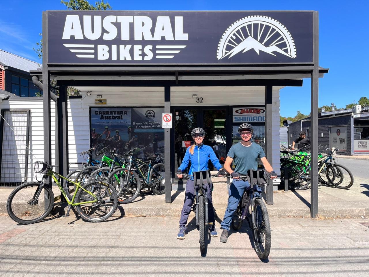
Bike and Outdoor Rental
Need a quote?
Send us an email to: info@australbikes.cl
Cycling the Carretera Austral North route between Puerto Varas and Coyhaique
NEED LODGING?
Please, write us a message: info@australbikes.cl if you need help with some bookings, although we advise that only for your first and final dates.
It’s very risky to do that for other days, as you may need more days to explore while on your journey, or the road might be closed for one or two days due to climate: rain, snow or river floods.
Puerto Varas – Coyhaique:
Total distance: 865 km.
Total days: 14
Difficulty: Medium / high
Road type: 90% pavement – 10% gravel.
not included
Airport transfer to Puerto Varas: arrival from Tepual Airport – Puerto Montt.
Bus Returning from Coyhaique.
– Bus/Air Flight Tickets Returning from Coyhaique to Puerto Montt.
– Tickets for any of the ferries.
– Airport transfer to El Tepual Airport in Puerto Montt: Return to Santiago.
– Guide
self guided tour
included
__________________________________________
Bike rental: 14 days included. Excellent quality bikes, Merida brand, specially selected for the trails of the zone and the gravel road on Carretera Austral (easily handleable).
Bike Pickup at Puerto Varas
Bike Dropoff at Coyhaique.
All of our services include: Topeak Explorer Rear Racks, Ortlieb waterproof panniers 40 lts (20 lts each side), handlebar bag (15 lts), mini-triangular frame bag, Gyro helmets, bottle cage, lock, lights, spare tubes, multi tools, tyre levers, allen wrench set, pump, chain cutter, quick link, patches, glue and reflective vests.
Our network of over 100 establishments along the Carretera Austral – from Puerto Varas to Villa O’Higgins – including hotels, hostels, cabins, campsites, restaurants, tourist activities, and shops, that offer special discounts.
Why choose us?
Because we’re not just handing you a bike — we’re riding with you every step of the way.
Top-quality MTB bikes (Merida) built for Patagonia’s wild terrain.
Fully equipped: Ortlieb waterproof panniers, handlebar bag (15 litres), mini-triangular frame bag, helmets, locks, front and rear lights, gel seat cover, spare tubes, tools and reflective vests. — all included in the rental. No hidden fees.
Mechanical support all along the route: with our network of 22 trusted mechanics.
Luggage forwarding, from your starting point to either destination you choose: Puerto Varas, Coyhaique, Puerto Rio Tranquilo or Villa O’Higgins, so you can ride light and free.
Flexible pick-up and drop-off locations: Puerto Varas, Coyhaique, Puerto Río Tranquilo, and Villa O’Higgins.
And most importantly:
We’re available on WhatsApp 24/7 during your trip — so you’ll never be truly alone out there.
make your reservation

STILL FEELING ADVENTUROUS AND WANT TO CONTINUE 6 MORE DAYS?
216 km extra
You’ve already explored the magic between Puerto Varas and Coyhaique — a stunning two-week ride through fjords, forests, and snow-capped peaks.
But what if the journey didn’t have to end there?
Extend your adventure to 20 days and keep pedaling south to Puerto Río Tranquilo, where the landscapes become even wilder and the rewards even greater. And don’t worry — you can drop off your bike right there in Puerto Tranquilo.
On the way, you’ll pass through Cerro Castillo — a hidden gem with jagged mountain spires, glacier-fed lagoons, and world-class trekking routes that rival Torres del Paine (without the crowds).
** Further south lies Puerto Río Tranquilo, gateway to the surreal Marble Caves, the vast Exploradores Glacier, and endless possibilities for hiking, kayaking, or just staring in awe at the raw beauty of Patagonia. This stretch of the Carretera Austral is a must for any true adventurer.
The stretch from Coyhaique to Cerro Castillo is a classic ride on the Carretera Austral — 97 kilometers of winding roads, open valleys, and unforgettable mountain views.
If you’re well-prepared and fit, it can definitely be done in a single day.
Our advise is to take it slow and soak it all in, we recommend splitting it into two:
– Day one from Coyhaique to the small village of El Blanco
– Day two from El Blanco to Cerro Castillo, where you’ll conquer the legendary Cuesta del Diablo — a challenging climb with epic rewards at the top.

DAY 15: Coyhaique to Villa Cerro Castillo: Rock Formations, Turquoise Rivers and the Cuesta del Diablo Distance: approx. 90–95 km | Elevation gain: +700–900 m | Road condition: paved
Leaving Coyhaique, the road opens up into wide Patagonian valleys and long, gentle straights that make the first part of the ride feel surprisingly smooth and fast. The surface is fully paved, and the terrain is mostly flat to gently rolling, allowing you to build a steady rhythm as the city slowly fades behind you and the wild landscapes return.
Near the small area known as El Blanco, the scenery takes on a surreal feel. Strange and fascinating rock formations, shaped by centuries of wind, ice and geological forces, rise from the land like silent stone sculptures. These formations, part of an ancient volcanic and sedimentary history, give the landscape an almost otherworldly appearance and make this section one of the most visually unique of the entire Carretera Austral.
As you continue south, the environment shifts once again. Towering peaks begin to dominate the horizon, signaling your arrival to the legendary Cerro Castillo National Park. This protected area is famous for its jagged mountains, turquoise lagoons, hanging glaciers and dramatic alpine landscapes — often compared to Torres del Paine in its beauty and intensity.
Then comes the highlight (and the test): La Cuesta del Diablo. This iconic climb is one of the most challenging stretches of the whole journey. The road rises in sharp curves, demanding strength, focus and patience. Every turn reveals bigger views — deep valleys, snow-capped peaks and endless Patagonian sky. It is difficult, yes… but also one of the most rewarding climbs you will ever experience on a bicycle.
After conquering the Cuesta del Diablo, a long, flowing descent takes you straight into Villa Cerro Castillo, a small mountaineer town nestled at the entrance of the national park. Surrounded by towering rock spires and icy rivers, it feels like a true basecamp for adventurers.
Here, you can rest, refuel, explore hiking trails, or simply sit back and admire one of the most spectacular backdrops of the entire Carretera Austral.
DAY 16. Cerro Castillo to Puerto Río Tranquilo – 73 km
Leaving Villa Cerro Castillo, you ride straight into one of the most visually stunning sections of the Carretera Austral. The road winds alongside the turquoise Ibáñez River, its surreal blue color flowing between steep canyon walls and rocky cliffs. This stretch is mostly paved, but still includes some gravel sections that keep your focus sharp and your true adventure spirit alive.
The terrain is a mix of gentle descents, rolling hills and long open valleys framed by dramatic mountains. Massive rock walls rise on one side while wide Patagonian landscapes stretch out on the other. Waterfalls appear unexpectedly along the way, and every turn of the road offers a new panoramic view — snowy peaks, deep canyons, and endless sky.
As you get closer to Puerto Río Tranquilo, the scenery changes once again. The landscape opens up and the immense General Carrera Lake begins to reveal itself in the distance — a deep, electric blue lake so vast it feels like an ocean surrounded by mountains.
Arriving in Puerto Río Tranquilo feels like stepping into a small expedition base. This lively little village is famous for one of the greatest natural wonders in Chile: the Capillas de Mármol (Marble Caves). From here, you can take a boat or kayak tour to explore the incredible marble formations carved by water and wind over thousands of years — swirling white and blue patterns reflected on the lake’s surface.
Beyond the caves, Tranquilo also offers glaciers, hidden lagoons, bike routes, trekking trails, camping areas, small lodges and local restaurants where you can enjoy a warm meal overlooking the lake. Many cyclists choose to stay an extra day here to fully explore the area and give their legs a well-deserved break.
This is not just a stop on your journey — Puerto Río Tranquilo is one of the true highlights of the entire Carretera Austral

DAY 17. Puerto Río Tranquilo – Marble Caves & Glacier Exploradores
You’ve arrived in Puerto Río Tranquilo, one of the most scenic and unforgettable stops along the entire route. No kilometers to cover on your bike today, but there’s plenty to discover.
First, the star of the show: the Catedral de Mármol, or Marble Caves.
These surreal rock formations rise directly from the turquoise waters of Lago General Carrera. Sculpted over thousands of years by waves and wind, the caves glow in swirling patterns of blue and white — and the best way to see them is by kayak or small boat.
Sunlight reflects off the water and dances along the stone, creating a dreamlike, otherworldly experience. Early morning is best, when the light is soft and the water calm. It’s not just beautiful — it’s peaceful, meditative, and completely unique.
If you’re looking for a different kind of adventure, head inland toward the Glaciar Exploradores.

